Get the most out of your capital allocation, simplify your planning
and maximize savings with Coordinate conflict resolution and resource optimization
Less Spending, More Efficiency
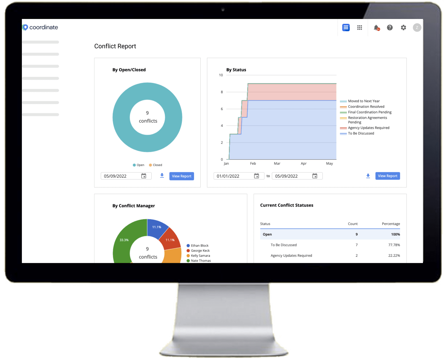
Understanding how federal funds and tax payer dollars are being spent within local governments is crucial and Coordinate adds a completely new layer of visibility for cities to better manage and allocate funds to projects. Once Coordinate is up and running, robust reporting and analytics will be leveraged to understand how money is being spent and how efficient cities are with their projects. A very common pain point Coordinate helps alleviate is redundant repavings in highly congested areas. This cost analysis data can be a fantastic metric to relay back to the public and keep communities happy and congestion free!
Save Like Seattle
Since implementing Coordinate as their right of way management solution, Seattle’s Department of Transportation improved the visibility into all projects happening in the city and reported a total savings of $7 million dollars in their first year.
Features & Benefits
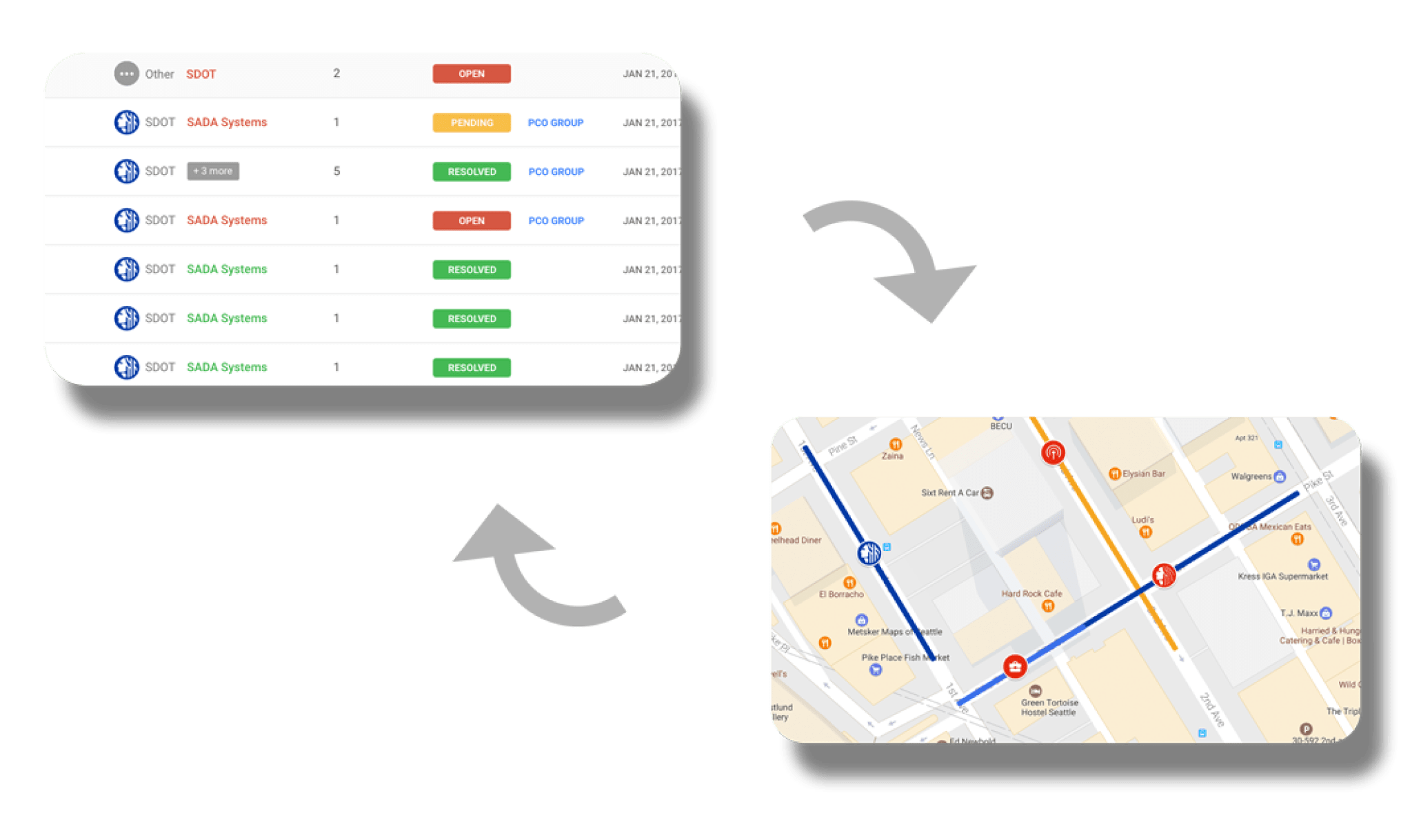
Geospatial
Integrate with Google Maps, ESRI and other mapping providers for complete visualization into your projects.
Onboarding
We use Google’s design principles for a seamless user experience. Our customer success team will work with you at every step.
Save Time and Money
Save construction days and material costs by improving collaboration and project coordination processes.