Visualise all your public works projects on Coordinate
and identify conflicts and cost-saving opportunities
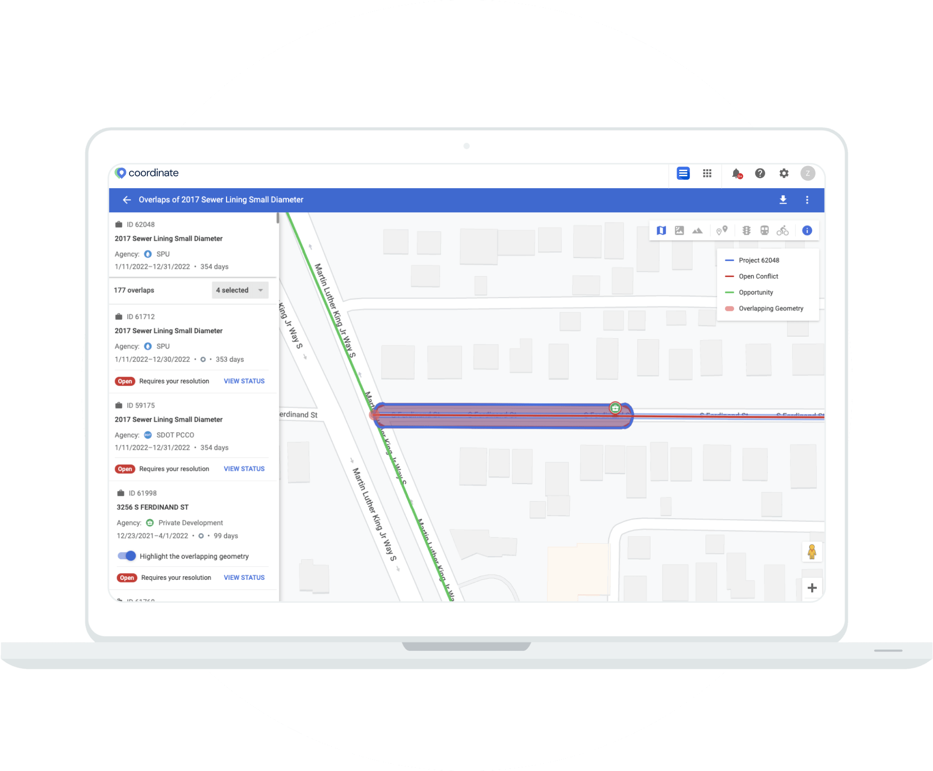
Resolve Conflicts and Cut Costs
Coordinate is designed to help cities and municipalities better coordinate projects in the right-of-way. The application enables city governments and outside utility companies to map, visualise, notify and resolve overlaps in projects between agencies. The tool will also support long term planning and communication of projects and closures to the public.
Streamline Communication
Municipalities, utilities, government agencies and private entities are all working on independent projects. Coordinate provides you a platform to view scheduled projects and coordinate right-of-way activities in real-time, minimising conflicts, costs and manual data entry.
Features & Benefits
Geospatial
Integrate with Google Maps, ESRI and other mapping providers for complete visualization into your projects.
Onboarding
We use Google’s design principles for a seamless user experience. Our customer success team will work with you at every step.
Save Time and Money
Save construction days and material costs by improving collaboration and project coordination processes.