Manage your project lifecycles and leverage powerful
tracking tools to maximize returns
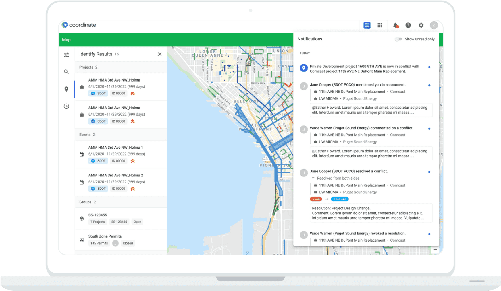
Transparency On All Levels
Tracking the status of projects and when roads will ultimately be cleared and repaved is a part of the core functionality of Coordinate. We want to help municipalities manage the work that is specific to their own departments while also allowing a window into the work private utilities are completing as well. Project details are shared with all appropriate super-users within Coordinate and allows for a level of transparency that cities and local communities need.
Streamline Solutions
Access information on any project, team, or company anytime. Enable automated conflict alerts and capitalize on opportunity management solutions to optimize on your outcomes.
Features & Benefits
Geospatial
Integrate with Google Maps, ESRI and other mapping providers for complete visualization into your projects.
Onboarding
We use Google’s design principles for a seamless user experience. Our customer success team will work with you at every step.
Save Time and Money
Save construction days and material costs by improving collaboration and project coordination processes.